Smart Optical Sensors for Fire and Smoke Science
The SMART FIRES project is leveraging cutting-edge technology to better understand fire behavior, smoke dispersion, and fuel conditions. Four key instruments—High Spectral Resolution Lidar (HSRL), All-Sky Polarization Imager (ASPI), Smart Unoccupied System Hyperspectral Imager (SUSHI), and the Thermal UAS Imager—are at the core of this effort. Each provides unique insights, and together they form a powerful toolkit for prescribed burn research and management.
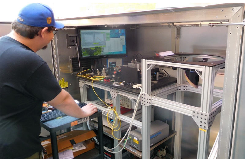
High Spectral Resolution Lidar (HSRL)
Developed by Dr. Kevin Repasky and graduate student Dylan Maxwell
What is the HSRL?
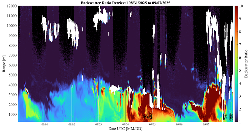
The HSRL is an active optical remote sensing instrument designed to profile the lower atmosphere. It sends out 7,000 laser pulses per second and measures the time it takes for light to scatter back from particles in the air. Each returning photon provides a location data point, allowing researchers to build a detailed picture of aerosol distribution and atmospheric structure.
Why is this important for SMART FIRES?
Smoke movement depends heavily on atmospheric structure, particularly two layers:
- Mixing Layer: A turbulent zone near the surface where air is well-mixed. Smoke trapped here stays dense and close to the ground, impacting local air quality.
- Planetary Boundary Layer (PBL): The lowest part of the atmosphere influenced by the Earth’s surface, typically extending up to 1–3 km during the day. Smoke rising above the PBL enters the free atmosphere, where stronger winds can transport it over long distances.
By profiling aerosols and these layers, the HSRL helps predict where smoke will go and how it interacts with weather systems. This capability will be integrated with other technologies to provide real-time insights during prescribed burns and optimize timing for safer, more effective fire management.
Technical Highlights
- Spectral Resolution: Differentiates aerosols from molecules like water or oxygen.
- Aerosol Characterization: Identifies scattering properties (e.g., dust vs. smoke).
- Field Deployable: Measures about 1 × 2 × 2 meters; being outfitted with housing and shock absorbers for transport to sites like Lubrecht Experimental Forest.
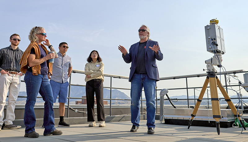
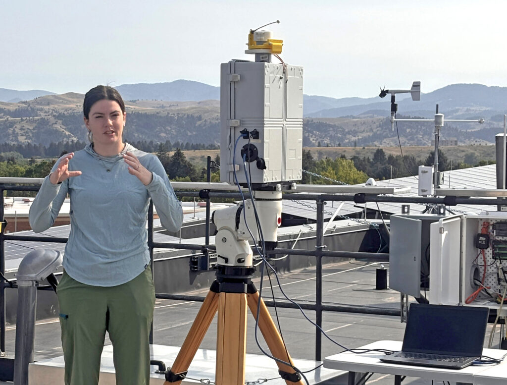
All-Sky Polarization Imager (ASPI)
Developed by Dr. Joe Shaw and graduate student Morgan Hasenmyer
What does ASPI do?
ASPI is a passive remote sensing instrument that captures the polarization state of light across the entire sky. Using a specialized camera with a microgrid polarizer, ASPI measures both the intensity and direction of oscillation of incoming light. These patterns reveal particle shape and orientation:
- Ice crystals in clouds create distinctive halos, such as the 22-degree halo.
- Analysis of these patterns allows inference of particle size distributions and densities, though not exact composition.
ASPI’s full-sky view sets it apart from other imagers that only capture small portions of the sky. It has already been deployed in field campaigns, including a three-day test at Lubrecht Experimental Forest, and is currently in performance assessment.
How is ASPI similar to and different from HSRL?
- Similarities: Both characterize aerosols and atmospheric conditions for smoke behavior analysis.
- Differences: HSRL is active, sending laser pulses for vertical profiles; ASPI is passive, analyzing natural light polarization for a horizontal, integrated view.
Together, they provide complementary perspectives—HSRL maps vertical structure, ASPI captures the full-sky distribution.
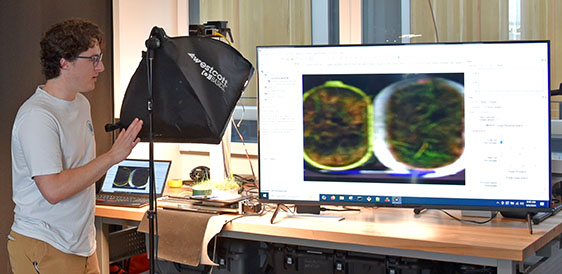
Smart Unoccupied System Hyperspectral Imager (SUSHI)
Developed by Dr. Ross Snider and graduate student Nat Sweeney in collaboration with Resonon
What is hyperspectral imaging?
Hyperspectral imaging splits incoming light reflected from a target into hundreds of narrow wavelength bands. This reveals subtle differences in material properties invisible to standard cameras.
For SMART FIRES:
SUSHI will will likely be attached to a drone and/or rover to scan ground fuels and classify areas as likely or unlikely to burn, creating GPS-based maps from the reflectance in the visible to near-infrared range (400 to 1000 nm). It can work alongside other varieties of imagers for richer data.
Unlike traditional systems that store data for later processing, this “smart” version integrates machine learning directly into the hardware for real-time classification. Sweeney integrated a reconfigurable FPGA* chip with a CMOS** detector to allow for implementation of custom hardware to enable the real-time analysis.
* FPGA: Field-Programmable Gate Array – a reconfigurable integrated circuit, meaning it can be programmed and reprogrammed after manufacturing.
** CMOS: Complementary Metal-Oxide-Semiconductor – a type of image sensor commonly used in cameras, including hyperspectral imagers.
Why is this unique?
Smart hyperspectral systems are rare. While Resonon provides the optics, Sweeney’s design adds intelligence for immediate decision-making. Features include:
- Optics from Resonon
- CMOS sensor
- FPGA chip for reprogrammable real-time processing and inferencing
- Custom circuit boards to integrate the FPGA chip and CMOS sensor
Designing circuit boards is painstaking work. As Sweeney joked, “I’ve learned to eat a big breakfast before heading into the soldering lab!”
Future goals include miniaturizing the system, enabling wireless connectivity to the camera, and investigating unique distillation methods for machine learning models.
Beyond fire science
This technology is adaptable—for example, detecting plant diseases in agriculture, such as identifying potato viruses in large batches.

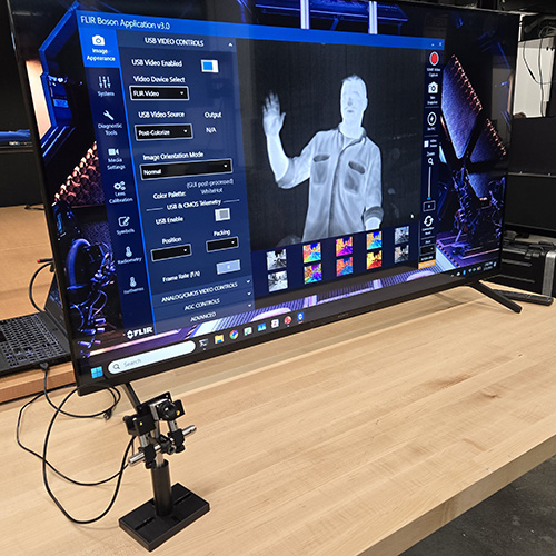
Thermal UAS Imager
Research led by Dr. Joe Shaw and graduate student Brandon Mickelson
What is the thermal UAS imager?
A thermal UAS (Unmanned Aircraft System) imager is an infrared payload mounted on a drone that detects heat radiation rather than visible light, translating temperature variations into color-coded imagery. Specifically, SMART FIRES is utilizing a FLIR Boson thermal camera.
What is the research focus?
Thermal imaging is a critical component of SMART FIRES because temperature strongly influences fire behavior, fuel conditions, and fire energetics. However, compact thermal cameras are highly sensitive to environmental conditions. This research focuses on improving camera accuracy so these sensors can be reliably used in field and airborne fire studies.
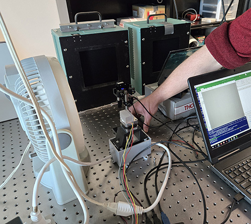
Why does calibration matter?
A major challenge with compact thermal cameras is that their measurements can drift as the camera’s own temperature changes. Factors such as air temperature, wind cooling (for example, when mounted on a drone), and sun exposure affect camera body temperature and, in turn, the accuracy of the measured scene temperature.
To address this, Brandon is performing tests and corrections to the camera’s response by:
- Measuring how wind cools the camera (simulated using a fan)
- Tracking changes in camera temperature
- Incorporating those temperature changes directly into the calibration process
The goal is to achieve temperature measurements accurate to within ±1°C, a level of precision needed for fire and fuels research.
How is the camera calibrated?
Calibration typically involves placing the camera in a thermal chamber, where both the camera temperature and the observed target temperature can be carefully controlled. By relating pixel values to known temperatures—and accounting for changes in the camera’s internal temperature—the team develops correction methods that improve accuracy across a range of conditions.
For this study, calibration tests covered scene temperatures from 5°C to 30°C, focusing on environmental effects rather than active flames. The resulting research paper will outline best practices for calibrating this class of compact thermal cameras under rapid changes in the camera’s temperature.
Why is this important for SMART FIRES?
Accurate thermal measurements add a critical data layer to SMART FIRES research:
- In fuels research, surface temperature can help infer fuel moisture content, an important predictor of burn behavior.
- Additional calibration research would extend use for studying fire energetics and heat distribution.
- When combined with hyperspectral imaging, thermal data provides a more complete picture of fuel characteristics.
Why these instruments matter
Together, the HSRL, ASPI, SHI, and thermal UAS imager offer complementary perspectives that strengthen SMART FIRES research:
- HSRL: Provides vertical profiles of aerosols and atmospheric layers, helping predict smoke movement and plume rise.
- ASPI: Captures full‑sky polarization patterns that reveal particle distributions and sizes across the sky.
- SHI: Conducts ground-level fuel characterization using real-time hyperspectral analysis to map fuels that are likely or unlikely to burn.
- Thermal UAS Imager: Measures surface temperature patterns from airborne platforms, contributing data on fire energetics and fuel moisture conditions.
Together, these instruments form a comprehensive, multi-layered system for understanding fuel conditions, fire emissions, and smoke transport—critical knowledge for planning, executing, and evaluating prescribed burns.