
From Lab to Field: Researchers Test Data Collection Technologies at Lubrecht Experimental Forest
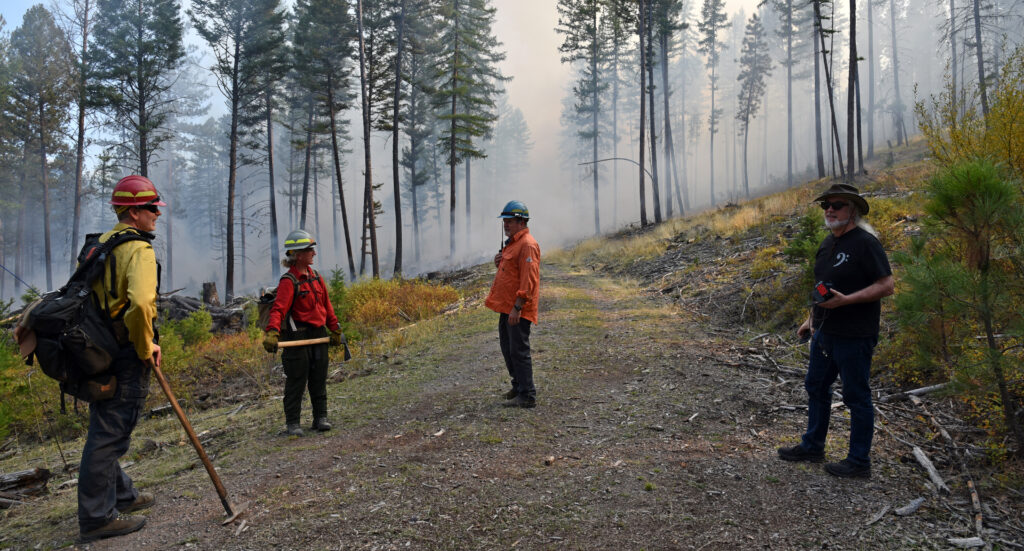
In late September, researchers from across the SMART FIRES network gathered at the University of Montana’s Lubrecht Experimental Forest to field test sensors, drones, and data collection systems designed to improve our understanding of wildfire, prescribed fire, smoke, and forest fuels.
Moving from the laboratory into the field represents a critical milestone for the project. Technologies that perform well under controlled conditions face entirely new challenges when exposed to uneven terrain, changing weather, smoke, sunlight, and the logistical realities of working in active forest environments. Field deployment allows researchers to evaluate how their systems perform under real-world conditions, identify opportunities for improvement, and collect data essential for advancing research objectives.
The September field day brought together teams from Montana State University, the University of Montana, Montana Technological University, and Flathead Valley Community College. Researchers tested a range of technologies in and around a prescribed burn, including atmospheric sensors, air quality monitoring equipment, hyperspectral imaging systems, drones, and a ground-based rover platform.
Among those participating were SMART FIRES team leads Joe Shaw of the Smart Optical Sensors research thrust and Carl Seielstad, Fire Lead for the Fire and Smoke Sciences team. Graduate students and faculty from several SMART FIRES disciplines worked alongside one another, highlighting the project’s interdisciplinary approach to understanding fire, smoke, and ecosystem responses.
Measuring the Atmosphere
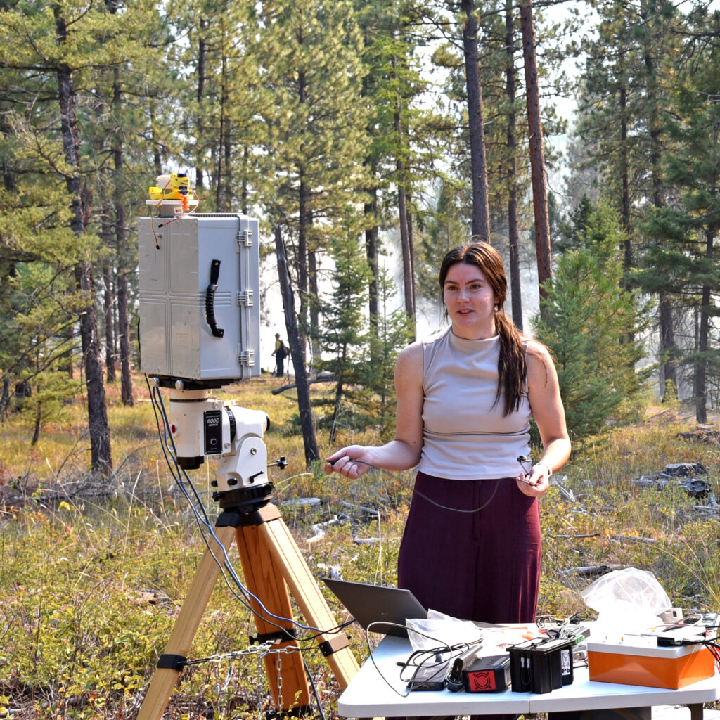
Montana State University graduate student Morgan Hasenmyer spent the day field testing the All Sky Polarization Imager, a passive remote sensing instrument that captures the polarization state of light across the entire sky, developed in Joe Shaw’s laboratory. The team compared its measurements with those collected by the industry standard AERONET instrument.
These side-by-side measurements help researchers evaluate the performance of new sensing technologies while collecting information about atmospheric conditions and smoke.
For Hasenmyer, repeated field deployments throughout the summer and fall have highlighted the unpredictable nature of prescribed-fire research and the importance of adapting to changing conditions in the field.
“I’ve learned a lot about the imager and the AERONET instrument, particularly how to set everything up and deploy it effectively in the field,” Hasenmyer said. “Each deployment has helped me better understand how to streamline the process and make data collection more efficient.”
Beyond the technical lessons, she was struck by how collaborative prescribed fire operations can be.
“As an engineer, we don’t often have many scenarios where team participation is such a large part of the process,” she said. “I’ve really enjoyed being able to go into the field, learn about fire and how burns are conducted, and still feel like I’m an included and contributing member of the team.”
This fall’s field deployments also marked an important step toward a major project goal: collecting and integrating data from prescribed burns to better understand fire behavior, smoke, and ecosystem impacts. Looking ahead, Hasenmyer expects field deployments to become even more frequent as researchers continue refining their instruments and building datasets that can support future research and management decisions.
Exploring Forest Fuels with a Rover and Drone
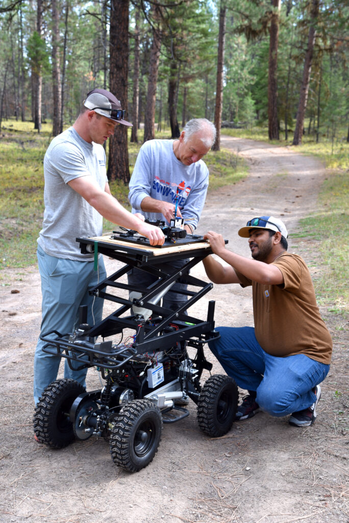
Montana State University graduate students Mahmad Isaq and Brandon Mickelson worked alongside Tim Price from Flathead Valley Community College (FVCC) to test rover- and uncrewed aerial vehicle (UAV)-based hyperspectral imaging and LiDAR systems designed to collect detailed information about vegetation, forest fuels, and surface conditions.
The ground-based rover represents a collaboration between institutions. Developed by Price and his team at FVCC, the platform began as a commercial youth ATV before being stripped down to its frame and rebuilt as a remotely operated research vehicle. Equipped with onboard electronics, a height-adjustable sensor platform, and the ability to carry a variety of scientific instruments, the rover can collect detailed measurements close to the forest floor while complementing data gathered from the air.
For Isaq, a Montana State University graduate student working at the intersection of machine learning and remote sensing with AI and Machine Learning researcher Brad Whitaker, the field day provided an opportunity to evaluate how the rover and drone systems work together to characterize forest fuels at multiple scales.
“We were testing rover-based and UAV-based hyperspectral imaging and LiDAR systems to collect detailed spectral information about vegetation and forest surface materials,” Isaq said. “These measurements will help us better understand forest fuel characteristics and explore how remote sensing and machine learning can be used to classify different fuel types.”
Field testing also highlighted the challenges that emerge when moving advanced equipment from controlled laboratory settings into real forest environments.
“Unlike in the lab, field conditions introduce challenges such as uneven terrain, changing sunlight, sensor positioning, and technical issues,” he said. “Although we encountered some difficulties with the rover, it was a valuable learning experience that will help us improve our future data collection.”
The team is working to combine the detailed ground-level measurements collected by the rover with broader aerial observations gathered by drones.
“The rover provides detailed spectral information at the ground level, while the drone captures spatial information over a larger area,” Isaq explained. “Together, these technologies can help us better characterize forest fuels at different scales.”
For researchers whose backgrounds are rooted in engineering and computer science, the field experience also offered new perspectives.
“For me, the most memorable part was seeing our research equipment and data collection protocol being tested in a real forest environment,” Isaq said. “As electrical engineers, we have little experience with forest and fire science, so it was exciting to learn how to address practical challenges in the field.”
Taking to the Air
Researchers from Montana Technological University deployed a heavy-lift ALTA X drone equipped with hyperspectral and LiDAR sensors to survey the study plot before a prescribed burn.
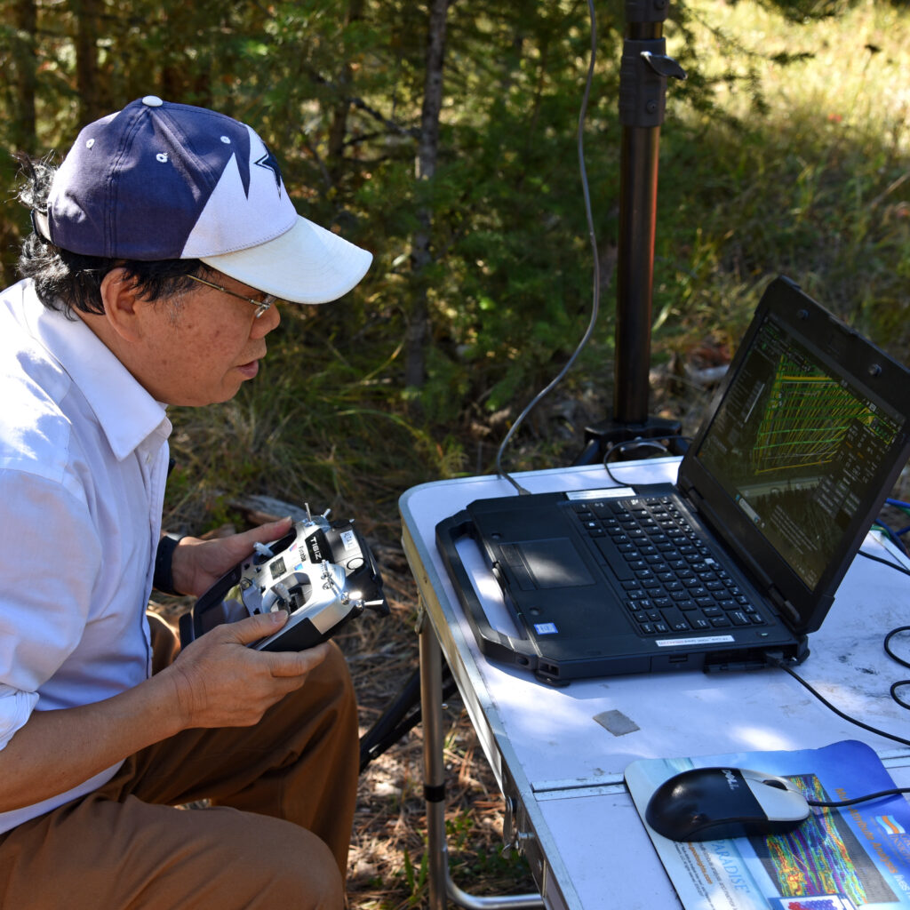
Led by Professor Xiaobing Zhou, the team successfully completed what may be their final pre-fire data collection flight before the burn. Additional flights are planned during and following the burn to document changes over time.
“Our objectives are to investigate spectral-band sensitivity to active burning and smoke, assess forest fuels and biomass, evaluate burn severity and burned biomass, and monitor post-fire tree and vegetation recovery,” Xiaobing said.
The data collected through these flights serve not only the Fire and Smoke Sciences research effort but also support other SMART FIRES teams, including researchers developing artificial intelligence and machine learning tools.
Graduate student Muhammed Umer Masood played a key role in preparing equipment, planning flights, monitoring operations, and verifying data quality in the field. When asked about his most memorable field experience, he recalled an earlier survey when a drone became stranded atop a pine tree.
“I climbed it to get the drone system back,” he said.
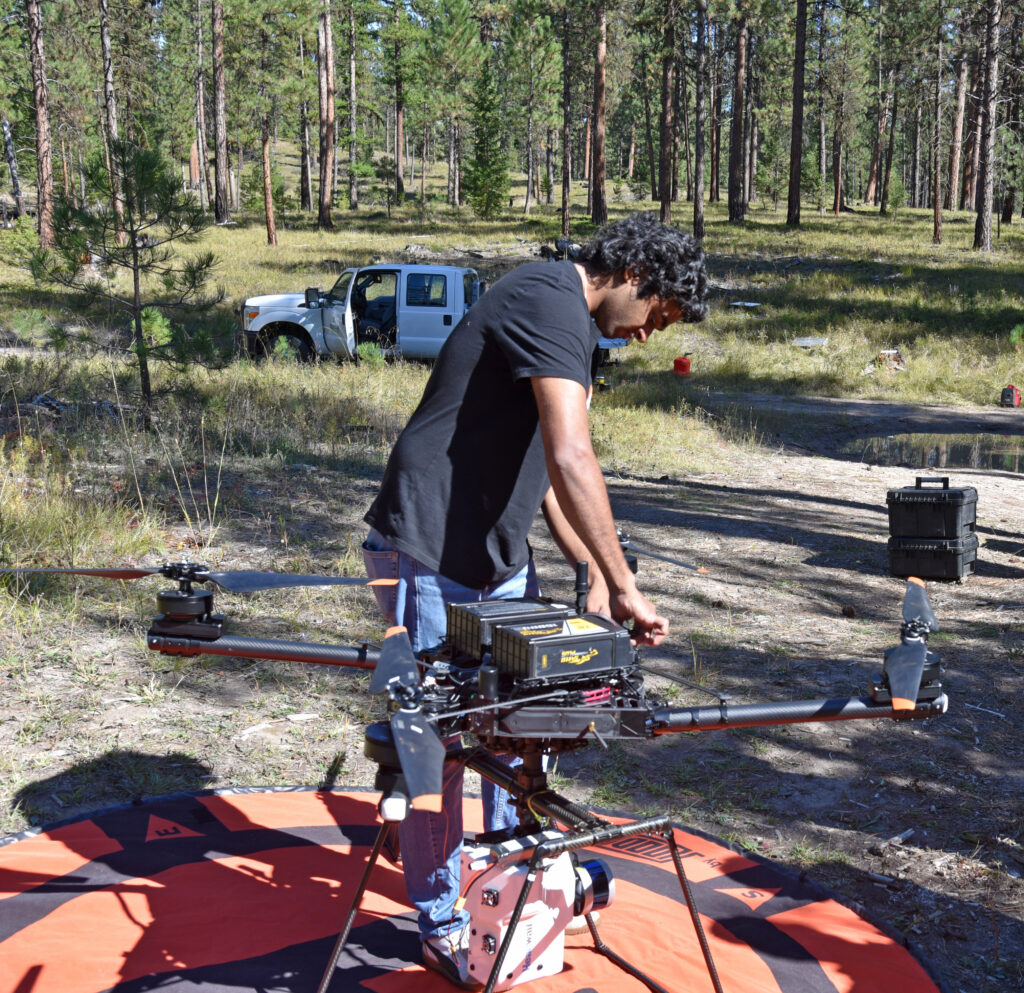
While this particular field day went more smoothly, the story highlights the challenges that can accompany fieldwork and the importance of adaptability when working with advanced technologies in remote environments.
“The field surveys require careful timing, as wind speed, sunlight, and cloud cover all affect data quality,” he said. “We have to plan around the weather conditions and make quick decisions.”
The effort provides both valuable data and hands-on workforce training.
“Through this project I have gained hands-on training in UAV mission planning, sensor calibration, field troubleshooting, and teamwork,” Masood said. “I also have a much better understanding of the data I analyze because I know exactly how it was collected.”
Following the Smoke
While aerial and ground-based platforms documented fuels and vegetation, another team focused on measuring smoke emissions from the prescribed burn.
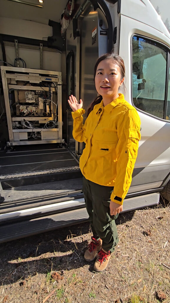
University of Montana graduate student Lu Tan, who works with Fire and Smoke Sciences Smoke Lead Lu Hu, operated the SMART FIRES Smokevan, a mobile laboratory packed with sophisticated monitoring equipment.
The Smokevan measures a broad suite of smoke components and atmospheric conditions, including carbon monoxide, carbon dioxide, methane, nitrogen oxides, ozone, particulate matter, black carbon, volatile organic compounds, and meteorological variables.
“Our Smokevan measures a wide range of gases and particles in the smoke,” Tan said. “One of the main goals is to better understand how prescribed-fire emissions compare to wildfire smoke.”
For Tan, the field day represented the culmination of years of work developing and refining the mobile monitoring platform.
“One of the most memorable parts of the day was seeing the whole mobile measurement system operating together in the field,” she said. “We have spent a lot of time building, testing, and troubleshooting the Smokevan, so it was exciting to see the different instruments successfully collecting data during an actual prescribed burn.”
The data collected will help researchers better understand emissions from prescribed fire and their potential effects on air quality and health, while also supporting efforts to optimize future prescribed fire practices.
Building Better Tools Through Field Testing
The field day illustrated an important aspect of SMART FIRES research: innovation does not stop when a new sensor, algorithm, or monitoring system is developed. Technologies must be tested repeatedly under real-world conditions, refined based on field experience, and integrated with complementary tools and datasets.
Many of the researchers involved have returned to the field multiple times throughout the summer and fall, continuing to improve their systems while building datasets that will support future fire and smoke research.
By bringing together expertise in optics, remote sensing, atmospheric science, engineering, artificial intelligence, and fire science, SMART FIRES researchers are developing tools that help answer complex questions about wildfire, prescribed fire, smoke, and forest resilience across the Northern Rockies and beyond.